Honeyeater Lookout Trail Guide: The Best Airlie Beach Hike
Airlie Beach may be best known as the gateway to the Whitsunday Islands, but it also has a hike you must not miss: the Honeyeater Lookout Trail.
Named after the honeyeater, an Australian song bird with a pointed beak which sucks nectar from the wildflowers along the hiking trail, the Honeyeater Lookout Trail is overlooked by many people who visit Airlie Beach.
Aside from being the main departure point for boat tours to the Whitsundays and Whitehaven Beach, Airlie Beach has a bit of a reputation as a party town. That makes the Honeyeater Lookout Trail in the Conway National Park even more of a breath of fresh air.
The eight-kilometre rainforest trail emerges at a lookout over Airlie Beach and the Whitsunday Islands. It’s also a great place to stretch your legs and look out for wildlife like lizards, honeyeaters (of course), and kookaburras.
After being stuck in Airlie Beach for six days during a storm which flooded the only road out of the town, hiking the Honeyeater Lookout Trail was exactly what I needed.
In this guide, I’ve covered exactly how to find the trail, what to expect, and most importantly, whether the trail is worth hiking.
Disclosure: This post includes affiliate links. If you decide to click through and make a qualifying purchase, I will receive a small commission at no extra cost to you – thanks for your support.
Where is the Honeyeater Lookout Trail?

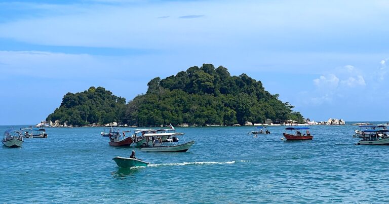
Whitehaven Beach, Whitsundays
The Honeyeater Lookout Trail is located in the Conway National Park in Queensland on the eastern coast of Australia.
The trail is accessible from Airlie Beach, a well-known departure point for boat tours of the 74 Whitsunday Islands (including the very famous Whitehaven Beach).
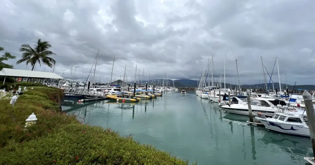
Coral Sea Marina, Airlie Beach
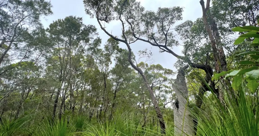
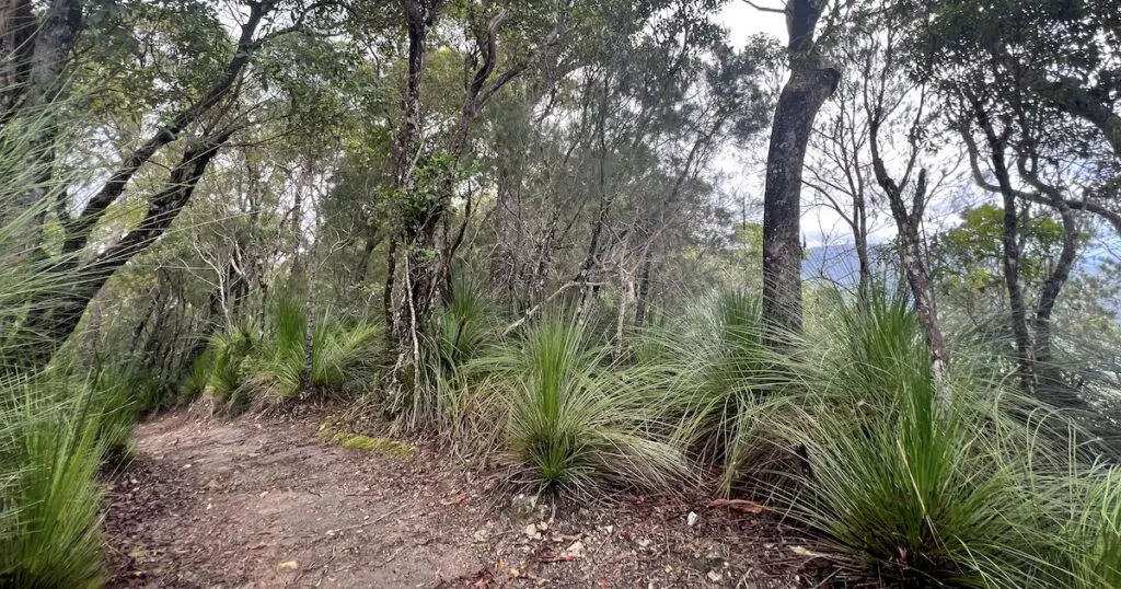
The Conway National Park stretches for 75 kilometres over the Cape Conway peninsula on the Queensland coast. It’s mostly made up of rainforest (lowland tropical rainforest, to be precise) but also has rocky cliffs and gullies. The greenery is mostly formed of hoop pine trees, mangroves, and vines.
AT A GLANCE:
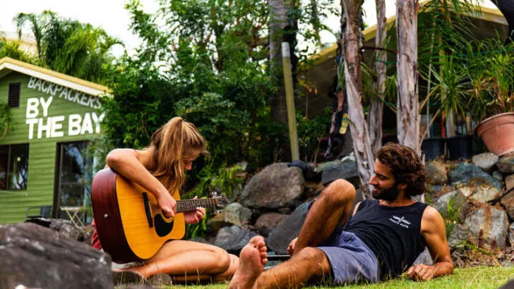
Best Hostels at Airlie Beach
Backpackers by the Bay
Credit: Hostelworld
Friendly hostel with a swimming pool and clean facilities.
YHA Airlie Beach

Credit: Hostelworld
Well-rated hostel with a pool and sociable atmosphere.
Best Hotels at Airlie Beach
Coral Sea Marina Resort

Popular waterfront resort with a pool, considered by many to be the best in the town.
BIG4 Adventure Whitsunday Resort

Huge resort just outside of town with family-friendly facilities and activities.
A Short History of the Conway National Park
The bush in the Conway National Park (and along the Honeyeater Lookout Trail) is very similar to the bush in the Whitsundays.
That’s because the national park is thought to have once been connected by land to the Whitsunday Islands. The theory is that when the sea levels rose, the mainland became separated from the islands.
The beaches in the national park are protected, as they form part of the Great Barrier Reef.
Thousands of years ago, the rainforest in the Conway National Park was occupied by the Ngaro and Gia indigenous people. They hunted and foraged within the rainforest.
Is the Honeyeater Lookout Trail worth it?
The Honeyeater Lookout isn’t as famous as the Whitsundays boat trips departing from Airlie Beach. However, the walk is a great escape from the busy harbour town and its many bars and backpackers.
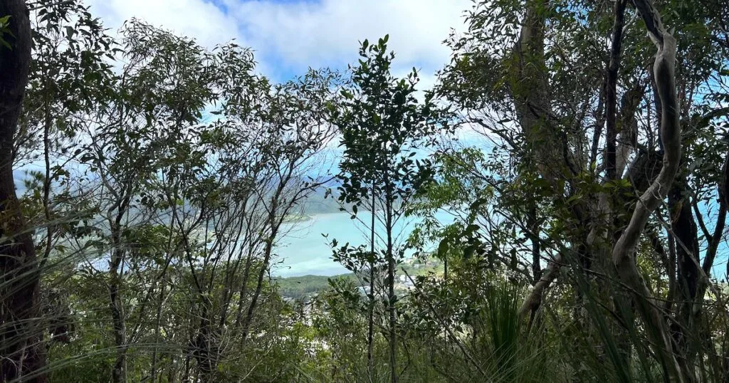
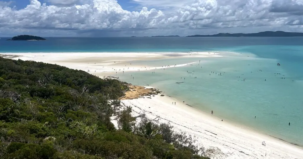
The lookout is the main attraction on the Honeyeater trail. The viewpoint looks out over the sloping rainforest, which stops just as the houses of Airlie Beach begin.
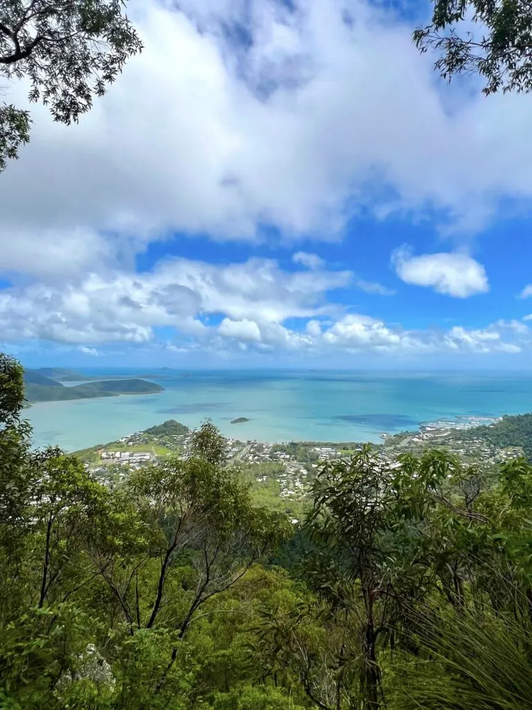
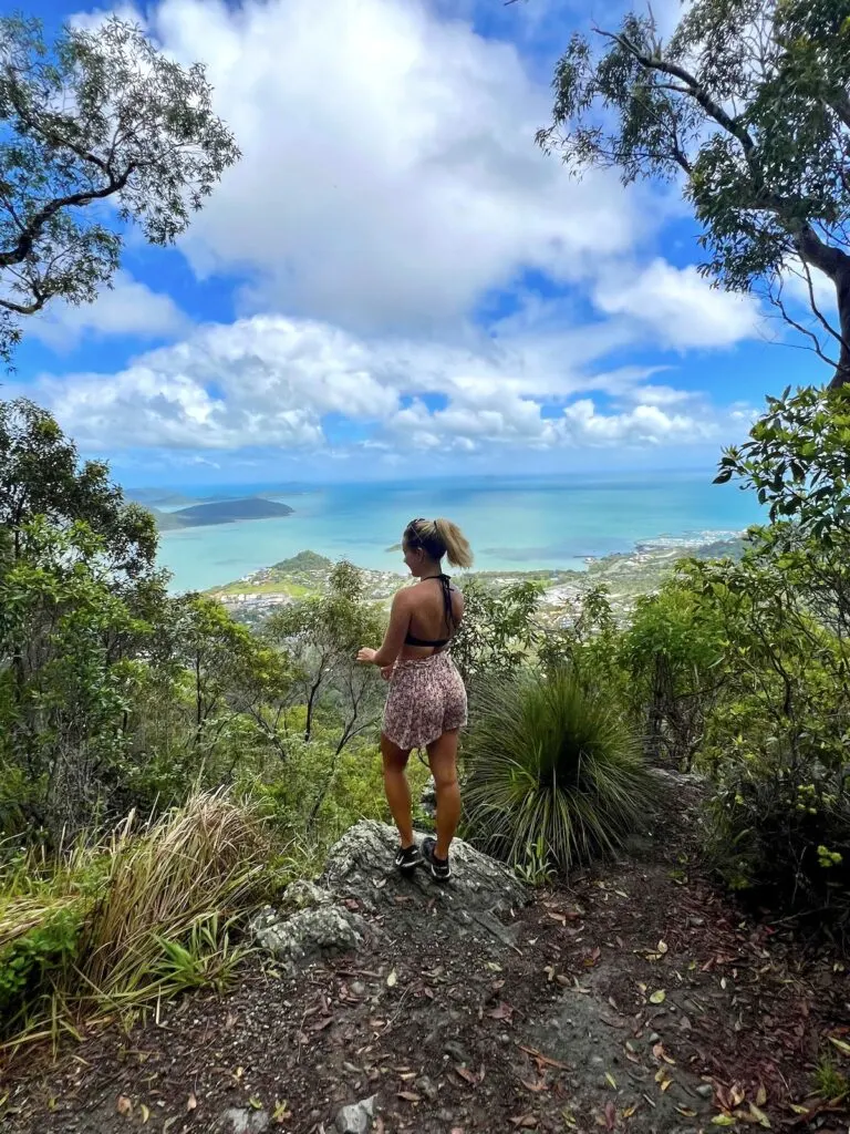
View from the Honeyeater walk lookout
From the lookout, spot Coral Sea Marina and some of the Whitsunday Islands. From high above Airlie Beach, the shade of the ocean looks a little similar to the famous blue streaks visible from Whitehaven Beach.
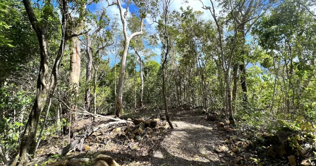
Aside from the one lookout, there are no other far-reaching views on the Honeyeater walk. The trail is covered entirely by rainforest, making it good for wildlife spotting.
The national park is well-known for two megapode (mound-building) Aussie birds, the orange-footed scrubfowl and the brush-turkey. Birdlife along the trail could include kookaburras, honeyeaters, the eastern yellow robin, and the square-tailed kite.
You can also spot wildlife like large lizards and spiders in their webs.
In short, the trail is worth hiking for:
- A lookout over the Whitstunday Islands and Airlie Beach.
- Exploring a rainforest setting.
- Birdwatching and wildlife watching.
- Getting out of town without taking a boat trip.
How long is the Honeyeater Lookout Trail?
The Honeyeater Lookout Trail is 8.2 kilometres long. It’s an out and back route. That means that you’ll follow the same trail to and from the lookout. The trail is almost entirely uphill and downhill.
According to the official signage outside of the national park, the trail should take hikers three hours to complete and mountain bikers one hour to complete. The former is the estimate for hikers with a high level of fitness, so in reality, the route could take longer than three hours.
How difficult is the Honeyeater Lookout Trail?
The Honeyeater Lookout Trail is marked as a Grade 4 trail, which according to official guidance from the national park, is advisable for people with existing bushwalking experience. A high level of fitness is required because the route has steep gradients.
As an out and back route, half of the trail is uphill and the other half follows the same route downhill.
The first half of the trail takes you to the lookout at an elevation of approximately 364 metres. The first three kilometres are the hardest, as they climb steadily uphill.
The next kilometre, however, is interspersed with a few small flat sections which give you a breather.
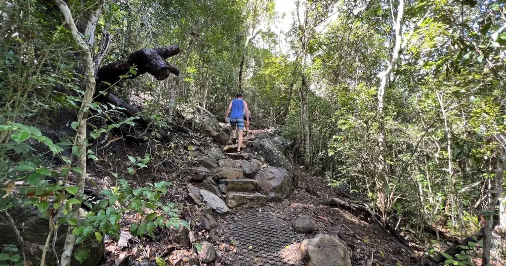
The downhill half of the trail is naturally less challenging. However, it will take some time and concentration to navigate due to the dirt and loose rocks on the trail.
There are honeycomb mats placed in sections near the foot of the trail to help with your grip on the descent.
I completed the trail in approximately 2.5 hours. For reference, it was my first proper bush walk in Australia. However, I’ve done challenging ungraded hikes in rainforests across southeast Asia which I considered far more challenging.
I also go weight training three to four times per week and consider myself to have a good level of fitness. I’m in my mid-twenties and I have hiked regularly since childhood.
It took me just over an hour and a quarter to go up and around an hour to go down. I’ve counted a brief 15 minutes rest at the lookout at the top of the trail in my timings.
Depending upon your level of fitness, the trail should take between 2 and 4 hours to complete out and back.
I have heard some hikers describe the trail as ‘easy’ and others as ‘very hard’ and ‘not suitable for children’.
My assessment is that while the trail is not technical, it requires a good level of fitness and fairly good hiking experience. The trail is straightforward to follow, but it can be slippery after rain and challenging on the uphill section.
It may not be suitable for kids unless they are well-accustomed to hiking uphill trails.
Cycling the Honeyeater Lookout Trail
Mountain bikers are permitted on the Honeyeater Lookout Trail. However, the trail is only suitable for experienced riders, and according to official signage, riders should ideally have personal survival skills.
The main hazards for mountain bikers are the loose gravel surfaces, steep gradients, and obstacles such as trees and large boulders.
How to Find the Honeyeater Lookout Trail
The Honeyeater Lookout Trail begins on Kara Crescent, a road in the hilly suburbs of Airlie Beach. Head to the far end of the main road in the town, next to Base Backpackers Airlie Beach and the NightOwl Convenience store.
If you were to turn right, you’d end up at the Airlie Beach lagoon. Instead, turn left after Base Backpackers and cross over the main road opposite the Hertz garage.
The street you want is called Bagley Street. Take an immediate left onto Lamond Street and begin to work your way uphill.

Airlie Beach Lagoon
Lamond Street merges left onto Kara Crescent, which you will want to follow until you reach the map of the trail.
The start of the Honeyeater Lookout Trail has a location on Google Maps, so you can find it easily by following the directions on your mobile phone.
Route and Map for the Honeyeater Lookout Trail
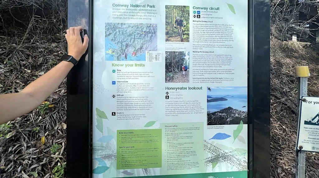
While there is a map of the route on the signpost at the entrance to the Honeyeater Lookout Trail, I’d recommend downloading an offline route of the map on AllTrails so that you can track your progress.
The trail follows the Conway Circuit for 2.3 kilometres. Then, it bears right for another 1.8 kilometres towards the lookout. Therefore, you want to make sure you take the correct turning.
With just the one crossroad, the trail is pretty straightforward to follow. Note that mobile signal and 4G is patchy, so an offline map is best.
Did you know that you can travel around Australia (almost) for free?
I saved over £1000 on accommodation in key locations like Cairns, Airlie Beach, and Sydney by petsitting using Trusted Housesitters.
Tips for the Honeyeater Lookout Trail
1. Hike the trail in the early morning
There is one main reason why you should hike the Honeyeater Lookout Trail in the early morning. It’s best to avoid the midday heat. The heat combined with the steep gradients is a recipe for a sweaty, difficult hike.
The trail is far more enjoyable between the hours of 7am and 10am when the weather is not as hot and humid.
It’s also better to avoid hiking the trail later in the afternoon because you want to make sure that you’re back in Airlie Beach way before it gets dark.
2. Don’t hike the trail in wet weather
The Honeyeater Lookout Trail is very prone to getting slippery. Even the morning dew can make the route a little wet.
The trail might be damp if it’s been raining for the former days too. I waited one day after the storm for the ground the dry slightly before tackling the trail. Even then, it was quite slippery towards the base of the trail.
3. Bring plenty of water (and snacks)
You’re hiking in the rainforest in Queensland, so it’s going to be hot and humid all year round. For a trail of this length, you need to make sure you bring extra water and food.
I usually bring around two litres for this type of trail. Snacks are always handy to have, as the uphill section of the trail is particularly demanding.
4. Be wildlife aware
The main hazards along the trail are bush snakes and spiders. The main thing is to be aware of your surroundings. Look where you’re walking and check overhead.
There were quite a few cobwebs (occupied or not) draped across the trail when I climbed it. You don’t want to walk headfirst into a spider web.
5. Wear closed shoes
You will need to wear closed shoes to avoid injuring your feet on any loose stones or tree roots on the trail. A large portion of the trail is formed of loose gravel, so this could also get into open shoes. Plus, closed shoes are always safer in the rare chance you encounter a snake on the trail.
6. Pack smart
There are some essentials you should bring along when you’re hiking the Honeyeater trail:
- A first aid kit, including bandages for snake bites.
- A raincoat and any additional wet weather gear.
- A generous supply of water and food.
- Sun cream.
- Insect repellant (treated with DEET to protect from mosquitos).
- A mobile phone (although signal is limited on some parts of the trail).
The Best Tours in Airlie Beach
If you’re visiting Airlie Beach, I’m assuming you’re interested in taking a tour of the Whitsundays. Good for you: it’s one of the most impressive destinations I visited on my three-month road trip between Cairns and Sydney.
Luckily, if you’ve left your tour to the last minute, it’s easy to book a day tour with a day or two’s notice.
I took the Whitsundays Ocean Rafting Tour and I can’t fault it. The tour guides were friendly, knowledgeable and very entertaining. Because the tour travels by speedboat, I didn’t experience any seasickness.
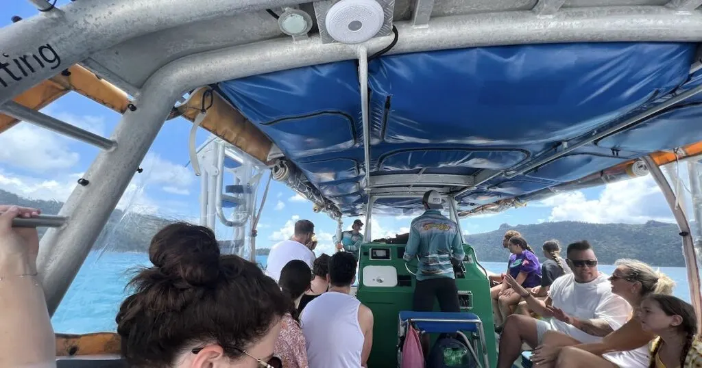
The tour visits two sides of Whitehaven Beach and a snorkelling spot over the reef.
I spoke to many other tourists and backpackers who have been on multi-day sailing tours and quickly narrowed down the best and worst trips, as well as the most sought-after. Let me summarise below:
The best day tour: Whitsundays Ocean Rafting Tour
Best family boat tour: Whitsundays Ocean Rafting Tour (1 day) or Camira Sailing Adventure (1 day – suitable for 4 years+).
Best backpackers tour: The Atlantic Clipper (2 days) or Avatar/Spank Me (2 days) – these tours sell out up to three months in advance, so book your spot early.
FAQ
No. Dogs are banned from the Honeyeater Lookout Trail.
Mountain bikers are permitted on the Honeyeater Lookout Trail. However, it’s not very suitable for cycling because of the steep inclines and hazards such as tree roots and loose stones and gravel. Bikers must give way to pedestrians and alert trail users when they’re coming.
The Honeyeater Trail starts from Kara Crescent in Airlie Beach.


Wow! The panoramic views left me speechless. It’s breathtaking! Great read likewise! 😀
Glad you enjoyed the article, Sid! Thanks for the feedback