Hiking Mount Hallasan: The Ultimate Guide to Climbing South Korea’s Highest Mountain
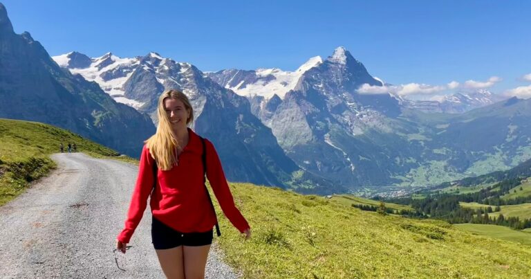
Hiking Mount Hallasan, South Korea’s tallest mountain, is something many people dream of doing.
Late last year, I finally ticked it off my own ever-growing bucket list – so I’m here to share my first-hand tips on booking the hike, getting there and which trail to choose (Seongpanak or Gwaneumsa).
Mount Hallasan, also known as Mount Halla, is a 1,947-metre dormant volcano located in the very centre of South Korea’s largest island, Jeju.
The mountain gets around 1,200 hikers every single day. To even stand a chance of hiking Mount Hallasan, you must reserve your hike days or even weeks ahead.
So, let’s not wait around, and I’ll cover everything you need to know to add the Mount Hallasan hike to your South Korea itinerary.
Disclosure: This post includes affiliate links. If you decide to click through and make a qualifying purchase, I will receive a small commission at no extra cost to you – thanks for your support.
Where is Mount Hallasan?
Mount Hallasan is at the centre of Jeju Island, South Korea’s largest island. Although the mountain is often hidden in an embrace of white clouds, it’s always there, quietly watching over the island.
For reference, Jeju is at the very southern tip of Korea, so as I explain in my guide on how to get to Jeju Island, you need to fly or take the ferry. There is a quick, easy flight from Seoul to Jeju.
The main trails to Hallasan summit, Seongpanak and Gwaneumsa, begin at different locations at the foot of the mountain.
However, you can’t just turn up to the trails unannounced – well, you can, but you won’t get anywhere – because entry is strictly controlled.
Wardens only permit hikers with valid QR-coded permits, timed to specific slots, onto the trails.
If you don’t have a QR code and a valid passport, you won’t get in. Likewise, if you’re too late for your timed slot, you’ll be turned away.
Is Hiking Mount Hallasan Worth It?
Hiking Mount Hallasan is something I’ve always wanted to do, not just to see the turquoise crater lake at the summit, but also because I read about its significance for Koreans.
It’s not just the highest mountain in the country; it’s spiritually important, a sacred place and symbolic of the country’s strength and endurance.
In Jeju, there’s a saying, “Jeju is Hallasan, and Hallasan is Jeju”. As the mountain is visible from almost anywhere on Jeju, it’s woven into the island’s history and identity.

For many years, Mount Halla has been a place of worship for the people who live on the island.
It also features in myths such as the legend of Seolmundae Halmang (a goddess who created Jeju).
It’s one of three big bucket-list mountain climbs in Korea: Seoraksan Mountain (I write about this in my Seoraksan National Park hiking guide) and Jirisan.
What Level of Fitness Do You Need to Climb Mount Hallasan?
You don’t need any special training to climb Mount Hallasan. However, you do need a good level of overall fitness.
Remember, you’re climbing the highest mountain in South Korea. On the easiest trail, Seongpanak, you must hike steadily uphill for at least 2-4 hours.

You also have to come back down, either on the same trail or on the harder route (Gwaneumsa), which can be tough on the knees.
If you take Seongpanak up and down, as you’ll see from the AllTrails map, the average completion time is 7 hours and 20 minutes. It also has a total incline of 1,158 metres.
How to Hike Mount Hallasan
Hiking Mount Hallasan isn’t as simple as turning up and walking. Hikers must register on the official Hallasan Visit Reservation System.
It can be quite confusing to use for the first time, so I’m going to guide you through it.

Firstly, select the trail for your route up the mountain (Seongpanak or Gwaneumsa).
Now, this is a very important decision because the trails vary in difficulty, length, and scenery – so please read my trail comparison in the next section.
Don’t worry about your route down the mountain. You can decide that on the day, after reaching the summit. For example, I selected the Seongpanak trail in the system but came down the mountain on the Gwaneumsa trail.
Next, you need to select your hiking date and the number of people. You can then select ‘reservation status’ to check the availability using the calendar view.
The calendar lists the number of hiking slots available per day, per trail.
Slots are released for the current and next month, so you can’t reserve your hike more than two months in advance.
Once you have confirmed your hike date, the system will guide you through registering your name and email address. Hiking Hallasan is free, so no money is taken at any stage.
What time should you start the hike?
The system will also prompt you to select the start time for your hike.
This, again, is extremely important because all hikers are required to pass checkpoints before set cut-off times, which vary season by season.
The up-to-date list of cut-off times are listed in section 2 on the official reservation guide.
On your climb up Mount Halla, you need to pass the checkpoints by the following times, or you will be turned back down the mountain.
| Seongpanak timings | Gwaneumsa timings |
|---|---|
| ASCENT Azalea Field Control Center – 11:30am (winter); 12:30pm (summer) | ASCENT Samgakbong Peak Control Station – 11:30am (winter); 12:30pm (summer) |
| DESCENT Summit – 1:30pm (winter); 2:30pm (summer) | DESCENT Summit – 1:30pm (winter); 2:30pm (summer) |
| DESCENT Azalea Field Control Center – 3:30pm (winter); 4:30pm (summer) | DESCENT Samgakbong Peak Control Station – 3:30pm (winter); 4:30pm (summer) |
I update this guide once per year, but the timings can change at short notice, so always cross-check with the official guide.
Here are my suggested timings for each trail:
- Seongpanak: Fast hikers should start before 8 or 9am in summer. Slow hikers should start before 7am.
- Gwaneumsa: Ideally, all hikers should start before 7am. If you’re a slow hiker, begin earlier.
For reference, I consider myself a fairly fast hiker. I started hiking Seongpanak at 7:45am. I reached the summit precisely three hours later (including two short breaks) at 10.45am.
The more time you have, the more relaxed your hike will be.
Which Mount Hallasan Trail Is Best: Seongpanak or Gwaneumsa?
1. Seongpanak Trail – The Easiest Route
Average time: 7h20 Hike length: 18.5 kilometres Incline: 1,158 metres
The Seongpanak trail is the easiest of the two routes to the Mount Hallasan summit. However, it’s still a challenging trail that requires at least 6-8 hours of hiking out and back.
Unless you are an experienced hiker who likes a tough physical and mental challenge, I recommend that you take the Seongpanak trail up Mount Hallasan.

The 18.5 kilometre trail takes most people around 4-5 hours to hike up, and 3-4 hours to hike down.
However, for me, it only took three hours with breaks to ascend.

The trail begins on a wooden boardwalk in a dense evergreen forest.
Eventually, the trees start to thin out and are replaced with oaks and maples, and the trail becomes a combination of wooden boardwalks and well-maintained dirt tracks.
Most of the Seongpanak trail is in the forest. It’s only at the final 10-15% of the trail that you emerge into open volcanic shrubland.

Honestly, I was pretty disappointed in the views on Seongpanak Trail. The forest is quite monotonous, and the final part of the trail (along an open wooden boardwalk with stairs) only had views of the clouds when I visited.
If the conditions are clear when you climb, you should be able to see the ocean.

Seongpanak Trail is not the most scenic trail on Hallasan by any means. However, it’s by far the easiest route up and down the mountain.
Therefore, considering I planned to climb up the mountain the easy way and come down the harder and more scenic route, I wasn’t too bothered.
I would have been more bothered if I had climbed up and down Seongpanak. The summit, with its views of the turquoise Baengnokdam crater lake, is undeniably pretty.
However, the wooden platform is crowded with tourists, as is the Seongpanak trail.
2. Gwaneumsa Trail – Longer and More Difficult, but so Scenic
Average time: 9h Hike length: 20.6 kilometres Incline: 1,565 metres
The second trail to the Mount Hallsan summit is the Gwaneumsa trail. It’s a longer and more challenging trail, with 20.6 kilometres and 1,565 metres of incline to its name.
As I mentioned before, I went down this trail (after hiking up Seongpanak). While I found my ascent on Seongpanak easy, I really struggled towards the end of the Gwaneumsa trail, mainly due to knee pain going downhill.
It’s a long hike back down the mountain. However, oh my goodness, the Gwaneumsa trail really made my Mount Hallasan hike worth every step.

After being disappointed by the views on Seongpanak, I was walking mouth-open for the first half an hour on the Gwaneumsa route.
The wooden boardwalk immediately descends into a series of chiselled, green valleys with beautiful forests and dramatic rockfaces.

There weren’t many hikers coming up Gwaneumsa Trail, which is a testament to how hard the trail is to ascend. Those that I did see were very out of breath or experienced trail runners.
Further down the mountain, I also came across a few devastated hikers who did not make it past the Samgakbong Peak Control Station before the cut-off time.
They weren’t permitted to complete their hike to the summit.
Partway down the trail, there is the beautiful ‘hanging bridge’, a large suspension bridge over the Tamnagyegok Valley.
This was one of my favourite parts of the trail and a key point for hikers going up the trail, as it’s located just before the tough push to the summit.
If you plan to go up Seongpanak and down Gwaneumsa, check out the AllTrails map for Seongpanak to Gwaneumsa.
Average time: 7h30 Hike length: 17.9 kilometres Incline: 1,171 metres
How to Get to Mount Hallasan
Most hikers aiming for the summit will need to be at their trailhead by 7 or 8am.
If you are renting a car, the trailheads are typically a 30-70 minute drive from most parts of the island.
If you’re relying on the bus, however, the best places to stay are Jeju City and Seogwipo.
Using the Korean navigation app Naver as a guide, I took the 281 bus directly from Seogwipo to the Seongpanak trail.

The Seogwipo bus stop for the 281 bus to Mount Hallasan
The Seongpanak trailhead is around halfway between Jeju and Seogwpio, on east side of Hallasan park. There is a direct bus from Seogwipo or Jeju City.
How to take the bus to Seongpanak
From Jeju City, take bus 281 from Jeju Girls’ Middle & High School (Ara Way) – you may need to take an additional bus (or taxi) here. After around 29 minutes, get off at the Seongpanak stop.
From Seogwipo, take bus 281 from Dongmun Rotary (South) bus stop (at the large roundabout between Paris Baguette and Yukhoe Take-out). After around 34 minutes, get off at the Seongpanak (East) stop.
The Gwaneumsa trailhead is at the north of Hallasan park on the Sallabuk-ro road. There are only connecting buses to the trailhead.
How to take the bus to Gwaneumsa
From Seogwipo, bus 281 from Dongmun Rotary (South) bus stop (at the large roundabout between Paris Baguette and Yukhoe Take-out). After around 48 minutes, get off at the Sancheondan Korea Polytechnic University (East) stop and cross the road to the West bus stop. Ride bus 475 for 6 minutes to the Gwaneumsa Temple Trail stop.
From Jeju City, take bus 426 for around 25 minutes from Dongmun Seongdan. At Cheomdan Gwagi Danji Entrance Gyohakchon Apartment, change to the 475 bus and ride for 16 minutes until you reach the Gwaneumsa Temple Trail stop.
Where to Stay in Jeju to Hike Mount Hallasan
If you are renting a car, you don’t need to think too hard about where to stay.
As I explain in my guide to where to stay on Jeju Island, Seogwipo and Seongsan are both good options.
If you are taking public transport to the Seongpanak or Gwaneumsa trails, Seogwipo or Jeju City are the best options.
I stayed at HY Choi Hostel in Seogwipo; it’s a 15- to 20-minute walk from the 201 bus stop.
Where to Stay in Seogwipo

Hotel Yeon (£££)

HY Choi Hostel (£££)
I stayed here!
Quick Packing List for Mount Hallasan
There are no shops on the Mount Hallasan trails, except for a basic shop selling noodles and small snacks at the foot of the trailheads. Therefore, you need to be completely self-sufficient and carry enough food and water.
Conditions on the mountain vary depending on the time of year. If you are hiking Mount Hallasan in cold weather, consider wearing thermals, a winter down jacket and waterproofs.
There are toilets stationed at regular intervals on the trails, but toilet roll is not guaranteed, so I suggest you pack a small roll.
Otherwise, this basic packing list should suffice:
- Water – at least 2-3 litres per person.
- Food and snacks.
- Several layers, including a waterproof jacket.
- Phone/camera.
- Sun protection (glasses, cream and hat).
- Hiking poles (recommended).
- Insect repellent.
- First-aid kit.
- Toilet roll
That’s all for my guide to hiking Mount Hallasan, South Korea’s tallest mountain. Leave a comment below if you have any more questions, and I’ll get back to you as soon as possible – or let me know how your hike goes!
Suggested reading:
- South Korea itinerary – start here!
- Seoraksan National Park hiking guide – the best mountain hikes near Seoul.
- How to get to Jeju Island
- Where to stay on Jeju Island
- How to get to Busan